Proposal for signage and other improvements to routes linking Marsh Mills to Efford, Higher Compton and Mannamead
Background
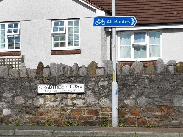
The only reasonably direct walking and cycling route between Crabtree near Marsh Mills and Military Road, Efford and onwards to Higher Compton and Mannamead is via a narrow, bumpy, unlit path. The route is shown on the PCC Cycling and Walking Map, but is not signed, so is used only by local residents and those cyclists who know how to find it. It forms a direct link between one of the less advantaged areas of the city and country access. Many residents work and shop at the ever expanding retail and commercial areas in and around Marsh Mills.
From Marsh Mills to the highest point at Efford cemetery is a climb of almost 100m.
The alternative routes for cyclists are:
- Via Delamere Road / Eggbuckland Road which is busy with traffic, narrows and steepens near the top emerging at the ‘Bluebird’ pub mini roundabout.
- Via Old Laira Road (The Narrows) which can be very intimidating for cyclists, then via Trefussis Park and the climb up Chapel Way/Revel Road to ‘The Rising Sun’ pub.
Please view these proposals in consultation with the location map.

Cyclists are currently signed towards the 2 crossings of the Parkway slip roads.
This route might be used by cyclists and pedestrians going W. up the cyclepath on the N side of the Parkway to the Leigham flyover, but I question whether for all other directions cyclists would be better directed via the footbridge.
The arrow on the tarmac either needs to point in both directions or be removed

Slip road into Sainsbury’s – This requires cyclists to look right at an acute angle and assess the speed of traffic entering Sainsbury’s. Children do not have that capability and wheelchair users might have a problem timing their crossing in fast-moving traffic.
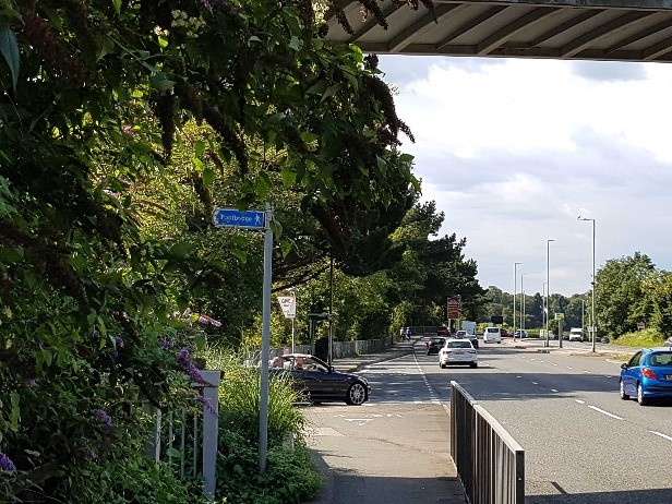
The sign indicates ‘footbridge’
Although shown on the PCC Cycling & Walking map this sign neither indicates destinations nor that it is a shared use route.
I suggest it directs to Efford, Higher Compton and Mannamead
The barrier is difficult for wheelchairs and bikes with trailers to negotiate
This directs cyclists to location 1. It is misleading and needs to be replaced. A sign pointing left directing cyclists and walkers to Efford, Higher Compton and Mannamead via the track through the tunnel is required.

This sign does indicate a shared use route but directs to ‘City Centre and Superstore’. Many destinations need to be included – Plympton, Plymstock, Saltram Park, NCN route 2 to City Centre.
Move sign to bridge pillar to be more obvious.
Location 5 -no photo – pointer to shared use path required

No indication that there is a path here or where it leads. It does need a sign stating Efford, Higher Compton and Mannamead and ‘via tunnel’ as some users might be uncomfortable using it.
No indication of where to go after emerging from tunnel into path to Willow Close. Destinations should include Superstore, Plym Valley, Saltram, Forder Valley and Plympton

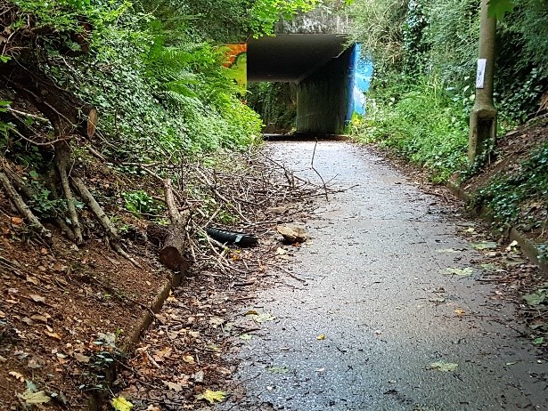
Tunnel entrance – this is overgrown and uninviting. There is lighting in the tunnel but the rest of the path is very rough and largely unlit. The vegetation needs to be regularly cut back plus a ‘shared use’ sign placed above the portal to assure users that they are on the correct path.
The path emerges in Efford at the junction or Military Road and Pike road on a blind bend. This is potentially the MOST DANGEROUS point on the route. Cars and commercial vehicles use Military Road as a ‘rat run’. It is unlit with no indicated speed limit.
- The corner hedgebank needs to be reduced in height to 1m. – not just cutting back the vegetation in order for a child to see oncoming traffic.
- AT THIS POINT THERE ARE 2 ALTERNATIVE ROUTES – (see map), one option via Pike Road / Efford Pathway, the other via Military Road.
A destination signpost is required with distances to Efford Cemetery. Wording needs consideration. - Signs are required from all 4 directions.
Approach from Military Road – there are no signs indicating a junction or the emerging path. I suggest a 20mph sped limit plus a ‘SLOW’ sign on the road with a rumble strip plus a sign informing drivers of the emerging path.

Approach from Military Road – there are no signs indicating a junction or the emerging path. We suggest a 20mph speed limit plus a ‘SLOW’ sign on the road with a rumble strip plus a sign informing drivers of the emerging path.
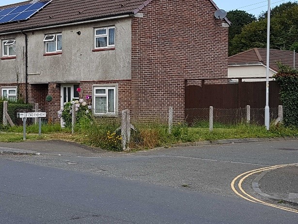
Efford Pathway – requires the sign to be replaced with destination signs visible from all directions. No one would know how to get to the track to the tunnel/ Marsh Mills from here.
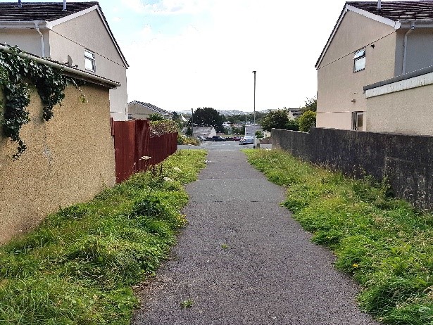
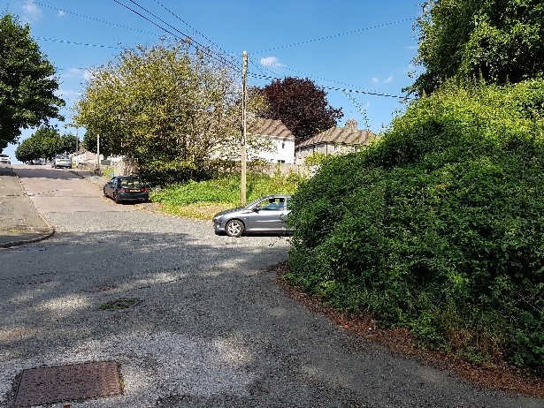
This is the route identified on the Plymouth Cycling map. It is unlit and not maintained with sawn down trees and large rocks almost blocking the path. Locations 12/13/14 –this whole section requires ongoing maintenance.

The 2 optional routes meet here and continue West to Efford Cemetery gates

There are no signs in any direction and the path is partially blocked with large rocks and rubbish.
The path is only partially lit

This barrier needs prominent orange or yellow/black tape on both sides. In poor light it is difficult to see when closed, heading West into a low sun. When closed the adjacent gap for cyclists is tight.

There is a no entry sign which needs to be changed to include ‘except fort cyclists’
A destinations sign is needed

Signs to/from all directions required.
